The River Nile - Main Facts
The River Nile is the second longest river in the world, after the Amazon River, and it is the longest river in the continent of Africa with a length of approximately 6695 kilometres. It flows through the following countries: Kenya, Eritrea, Congo, Burundi, Uganda, Tanzania, Rwanda, Egypt, Sudan and Ethiopia. The Nile is called this after the Greek word 'Nelios', meaning River Valley. The Nile used to flood once every year during the inundation season, what the Egyptians called Akhet, between June and September. It flooded onto the desert land because of of the rain and melting snow from the Ethiopian Mountains, causing a torrent of water to invade the river's banks, Now, the Nile doesn't flood anymore because of the construction of the Aswan dam in the 1960's.
The Nile's average dischatge per day is 300 million cubic metres. The average Water level height is 8 to 11metres deep.The width of the Nile after Aswan is in average 2.8 km. The widest part of the Nile is at Edfu, with 7.5 km in width, and the smallest part in width is at Silwa Gorge, near Aswan, being only 350 meters wide.
Transportation
Since the Nile's waters are calm from Aswan to the Mediterranean Sea, downstream boat transportation is ideal. During inundation season, the Nile's average speed of flow was about four knots, making the journey from Thebes north to Memphis last for 2 weeks. Whereas, during the summer, when the current flow was slower and the water level lower, that same trip would last approximately 2 months. Egyptian boats can travel easily upstream under sail because of thr North Wind. For the development of the united civilisation, this simple and natural transportation is a key element.
The Map of the Nile
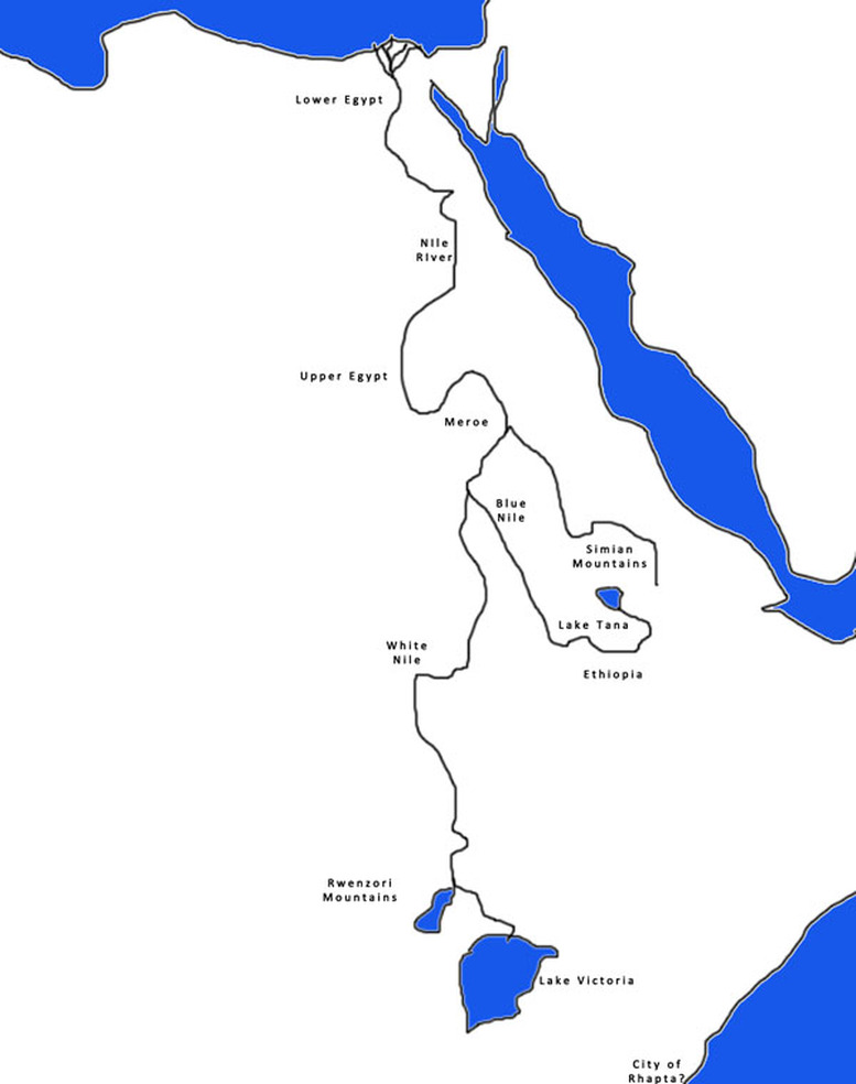
Here is a map of the Nile, from source to mouth. Both the White Nile and the Blue Nile are also situated on this map.
